These files need to be transfered from Trimble Office.
Text file (ex. exp1119a)
Shape file (ex. Lin_gen.shp)
Data Base File (ex. Lin_gen.dbf)
Propriatary file (ex.Lin_gen.shx)
(11-19-09)
Trimbles 560 page Geo XH Manual (.pdf)
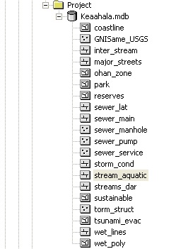
Some of the layers that are available for our project (the "Data Dictionary").
A Geographic Information System for Water Flow and Land Use in the Waimanalo Stream Drainage Basin (.pdf)More information about TeraSync software from Trimble
![]()
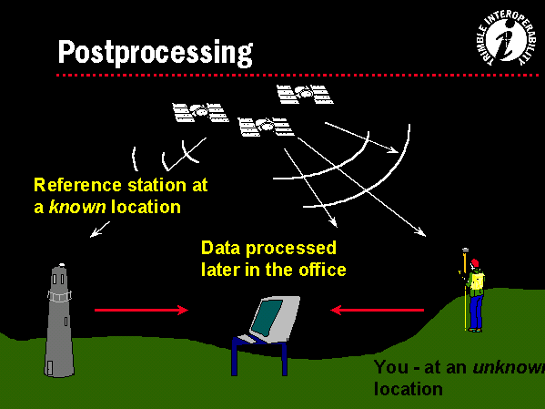
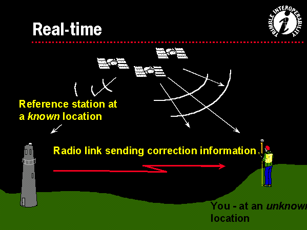
Differential Correction removes satellite timing errors, receiver timing errors, and atmospheric errors. An uncorrected signal is accurate to 7-8 meters or about 25-30 feet. There are two differential correction methods: postprocessing (above) and real-time (below.) The concept is the same. A base station is surveyed to 1-3cm accuracy. When the satellite signals reaches a base station, the base station recognizes the difference between its accurate surveyed position and the error position sent by the satellites. The correction is either saved to a hard disk for postprocessing or communicated real-time to the GPS receiver. .Real-time is valuable for navigation. Postprocessing is more accurate.